Bitte ändert euer Passwort!
Im März 2026 wurde das Forum gehackt. Dabei hatten die Angreifer Zugriff auf die Datenbank und somit Zugriff auf eure Passwörter. Auch wenn das Forum kein Passwort im Klartext speichert, können die Angreifer eure Passwörter knacken. Bitte ändert daher dringend euer Passwort für das Forum. Solltet ihr das gleiche Passwort auch an anderer Stelle verwenden, ändert es bitte unbedingt an allen Stellen!
So geht es:
Anleitung Passwort ändern
Google Map on your transmitter screen
- Harry Curzon
- Autor
- Offline
- Premium Mitglied
-

- Beiträge: 103
- Thanks: 257
Re: Google Map on your transmitter screen
10 Okt. 2021 15:15I checked it at the airfield today and the app is working correctly. I set the transmitter to speak out 4 values in sequence - triangle racing height, GPS absolute height, GPS relative height, vario relative height. The triangle height, and the two relative heights were all within a metre of each other, the GPS absolute height was higher by the field elevation. I will ask Dave to take a look in case he can think of why it is not working for you.
Bitte Anmelden oder Registrieren um der Konversation beizutreten.
- davidmcq137
- Offline
- Premium Mitglied
-
- Beiträge: 80
- Thanks: 91
Re: Google Map on your transmitter screen
10 Okt. 2021 15:51Thanks for the feedback and sorry for the problem.
First a workaround: there is a manual entry for field height in the settings menu, you can put the field elevation in meters there and it will be subtracted from GPS readings.
Now to help determine the issue, can you tell me what GPS you are using, and did you assign it manually using the Telemetry Sensors menu, or did the app automatically assign it? That will be a help to me.
It is our intent to do this automatically, so I would like to get to the bottom of it for you.
We get the field elevation from google maps, you can look at the file Apps/DFM-Maps/Maps/Fields.jsn and see what elevation we are using for your field if you are curious.
The penalties are computed according to the triangle racing rules gps-triangle.net/wp-content/uploads/2020...ns_sport_en_V1.5.pdf
In summary, if the max start height and speed are hmax and smax, and the entry height and speed are h and s, then penalty points are:
50 + 2*(s-smax) + 2*(h-hmax).
smax and hmax are settable on the race parameters menu and the default smax is 100 km/hr and the default hmax is 200m.
Dave
Bitte Anmelden oder Registrieren um der Konversation beizutreten.
- davidmcq137
- Offline
- Premium Mitglied
-
- Beiträge: 80
- Thanks: 91
Re: Google Map on your transmitter screen
10 Okt. 2021 16:02Bitte Anmelden oder Registrieren um der Konversation beizutreten.
- ClausS
- Offline
- Neues Mitglied
-

- Beiträge: 18
- Thanks: 3
Re: Google Map on your transmitter screen
10 Okt. 2021 20:09 - 10 Okt. 2021 20:22") .
.Maybe it´s also not a Bug but user-failure from my side.

My GPS sensor is a DIY Sensor from Nightflyer with a slightly modified Firmware.
github.com/nightflyer88/Jeti_VarioGPS-Sensor
I assigned the sensor manually. There was not automatic assignement done from the App.
Field elevation accoriding to the field.jsn is correct and matching real value.
This evelation is also shown as "ALT" value, when the plane is ready for start (on the ground).
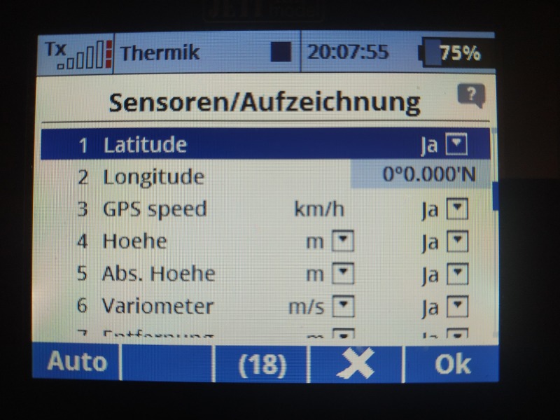
My GPS provides following height values:
"Hoehe" = relative height
"Abs.Hoehe" = absolute height (<-- I used this value in your App).
Thanks a lot for taking care
By the way: What´s the reason for not using relative height in general and ignoring field elevation?
BR Claus
Bitte Anmelden oder Registrieren um der Konversation beizutreten.
- davidmcq137
- Offline
- Premium Mitglied
-
- Beiträge: 80
- Thanks: 91
Re: Google Map on your transmitter screen
11 Okt. 2021 01:51For GPSs that are added manually, we assume they are relative altitude and do not subtract the field elevation. So for your GPS, since you can use absolute or relative, just choose relative and you will be all set.
Triangle racing rules require an absolute altitude and a supplied field elevation, which was part of our design consideration.
Perhaps I could also add an absolute/relative checkbox to the Sensor menu for a future release for manually added GPSs.
Thanks
Dave
Bitte Anmelden oder Registrieren um der Konversation beizutreten.
- ClausS
- Offline
- Neues Mitglied
-
- Beiträge: 18
- Thanks: 3
Re: Google Map on your transmitter screen
11 Okt. 2021 18:21thanks for your reply. It´s clear for me
.BR
Claus
Bitte Anmelden oder Registrieren um der Konversation beizutreten.